
Snow Squall Warning: What It Means for Schools, Driving and Safety in the U.S. and Canada
A Snow Squall Warning means a brief, intense burst of snow is expected or occurring that can rapidly reduce visibility, create whiteout conditions, and make roads icy. These events can develop and pass within less than an hour, so the danger is often the sudden change in travel conditions, not the total amount of snow that accumulates.
For drivers, parents, and students, the key question is not simply “How much snow will fall?” It is how quickly visibility and road conditions may deteriorate, when the squall will reach your route, and whether local travel or school transportation will be affected.
What Is a Snow Squall?
A snow squall is a short-lived period of intense snowfall that can produce a sudden drop in visibility, gusty winds, and rapidly worsening road conditions. In the U.S., the National Weather Service describes squalls as often associated with strong cold fronts and typically lasting less than an hour.
Unlike a long-duration snowstorm, a squall can arrive suddenly, cross a particular highway or community, and then move away while conditions a few miles away remain much better.
How Long Does a Snow Squall Usually Last?
At a particular location, a squall commonly lasts around 30 to 60 minutes, although conditions can change considerably within that window. NWS describes the warning itself as short-fused and focused on a distinct area.
That short duration is one reason a weather forecast showing relatively little total snowfall does not necessarily mean travel will be easy.
Can a Snow Squall Happen Without a Major Winter Storm?
Yes. A squall can occur without a large winter storm covering the region.
This is one of the most important things to understand: a localized burst of snow can create a serious travel problem even when the surrounding forecast does not look like a major snowstorm. NWS specifically notes that squalls may produce only minor accumulation while still creating localized extreme impacts for travelers.
Why Snow Squalls Can Become Dangerous So Quickly
The main hazard is the combination of several changes happening almost simultaneously.
Sudden Whiteout or Near-Whiteout Visibility
Heavy snow can reduce visibility dramatically within minutes. A driver who could see the road clearly moments earlier may suddenly have difficulty seeing vehicles, lane markings, signs, or the road ahead.
This creates an especially serious problem on highways because traffic may still be moving at normal speeds when visibility collapses.
Rapid Road Icing and Flash Freeze
A sharp temperature drop can cause wet or slushy pavement to freeze quickly. NWS notes that falling temperatures combined with snow can glaze roads with ice within minutes.
Bridges and elevated road surfaces can become particularly problematic because they can lose heat faster than surrounding pavement.
Gusty Winds and Blowing Snow
Wind can push falling or newly accumulated snow across the roadway, making visibility even worse.
It can also make the boundary of the dangerous area difficult to judge. A road can transition from relatively normal conditions to blowing snow and near-whiteout visibility over a very short distance.
Snow Squall Warnings in the U.S vs Canada
The U.S. and Canada both warn about this hazard, but their alert systems are not identical.
| Feature | United States | Canada |
|---|---|---|
| Main weather agency | National Weather Service (NWS) | Environment and Climate Change Canada (ECCC) |
| Squall warning | Snow Squall Warning | Snow Squall Warning |
| Squall-specific watch | No U.S. Snow Squall Watch product | A Snow Squall Watch can be used |
| Warning approach | Short-fused, localized warning | Impact-based alert framework |
| Additional information | General/Significant and source tags | Impact levels and forecast confidence |
| Phone alert | Significant events can trigger WEA | Uses Canada’s weather-alert system |
The important point is that the same weather phenomenon does not have to be communicated through identical warning products in both countries.
How the U.S. National Weather Service Issues Snow Squall Warnings
The NWS uses a short-fused warning for an intense, localized burst of snow that can cause hazardous travel conditions.
The warning is generally designed around an immediate travel threat rather than the total snowfall expected over an entire county or region. NWS describes these warnings as focused on distinct areas and typically valid for about 30–60 minutes.
Some local NWS criteria describe the combination of heavy snow, visibility around one-quarter mile or less, gusts around 30 mph or greater, and conditions capable of producing a flash freeze. Exact operational criteria can vary by forecast office, so these numbers should not be treated as one universal snowfall threshold for every U.S. warning.
How Canada Issues Snow Squall Warnings
ECCC’s current system focuses on the expected impact of localized, intense snow bands generated by open water or a front.
Its current Snow Squall Impact Guide describes impacts ranging from travel disruptions and collisions at the moderate level to dangerous or impassable routes and prolonged travel delays at the extreme level.
The Biggest Difference Between the U.S. and Canadian Alert Systems
The U.S. system has a short-fused warning with impact-based tags, while Canada’s current system uses impact levels together with forecast confidence to determine the appropriate alert color.
That means you should not assume that a yellow Canadian alert is simply the equivalent of a low-level U.S. warning. The two countries are using different alert frameworks.
Does the U.S. Have a Snow Squall Watch?
No. The U.S. does not have a dedicated Snow Squall Watch product equivalent to Canada’s squall-specific watch.
In the U.S., longer-lead communication can come through forecasts, outlooks, briefings, statements, and other messaging, while the Snow Squall Warning is the short-fused product used when the immediate localized hazard is expected or occurring.
What Do Yellow, Orange and Red Weather Alerts Mean for Snow Squalls in Canada?
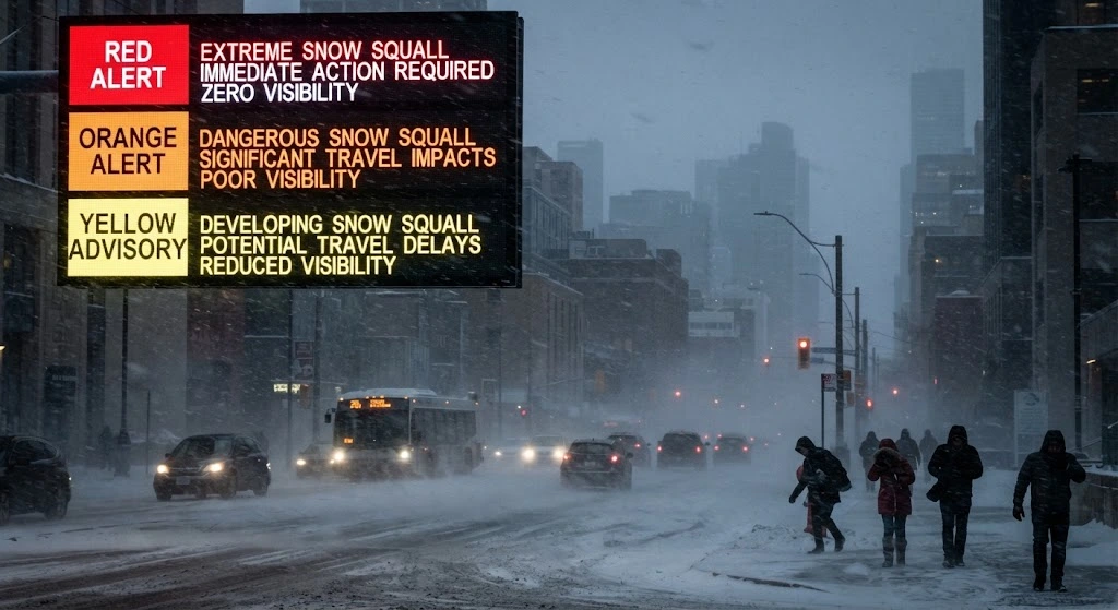
Canada’s current system should not be interpreted as a simple “yellow = mild, orange = bad, red = extreme” ladder.
ECCC uses an Alert Colour Matrix that considers both the expected impact and the confidence that the event will occur.
Why Alert Color Is Not Simply a Severity Scale
A weather event with higher potential impact but lower forecast confidence can receive a different alert color than an event with the same potential impact but much higher confidence.
ECCC says its forecasters consider observations, weather models, and forecaster expertise when determining confidence.
So when checking a Canadian alert, read the hazard, expected impacts, timing, and affected area, rather than interpreting the color by itself.
How Confidence and Expected Impact Work Together
ECCC’s current framework considers three broad impact levels for snow squalls:
- Moderate: travel disruptions, route closures, vehicle collisions, and some injury risk.
- High: dangerous travel, multiple collisions, long delays, stranded vehicles, and possible property or utility impacts.
- Extreme: very dangerous or impassable routes, prolonged widespread delays, stranded travelers, and significant disruption to essential services.
The final alert color also depends on forecast confidence. ECCC specifically explains that the matrix combines these two dimensions.
What the Moderate, High and Extreme Impact Levels Mean
Think of the impact level as answering:
“If this event occurs as expected, what could it actually do to people and transportation?”
That is more useful for travel decisions than looking at snowfall depth alone.
ECCC also notes that its Impact Guides describe primary impacts and do not directly include secondary effects such as business or school closures.
What Do General and Significant Snow Squall Warnings Mean in the U.S.?
The NWS added impact-based tags to distinguish lower-impact squalls from events that pose a substantial threat to safe travel.
What Is a General Snow Squall Warning?
A General warning is the standard warning without a “Significant” impact tag.
It is used for snow squall conditions where the threat to safe travel is expected to be reduced by mitigating factors and the surrounding societal context.
What Is a Significant Snow Squall Warning?
A Significant tag indicates that the squall poses a substantial threat to safe travel.
This distinction is important because it also affects how the warning is distributed to mobile devices.
Why Some Snow Squall Warnings Trigger a Phone Alert
Only Significant Snow Squall Warnings are designed to trigger a Wireless Emergency Alert under the current NWS impact-based system. General warnings do not trigger the WEA.
So if your phone alerts you during one squall but not another, that does not necessarily mean one forecast was “wrong.” The warnings may have carried different impact classifications.
What Is a Wireless Emergency Alert (WEA)?
A WEA is the emergency notification delivered to compatible mobile devices when qualifying alerts are issued.
For snow squalls, NWS limits this phone-level alert to the Significant category because that classification represents a substantial threat to safe travel.
Snow Squall Warning vs. Snowfall Warning vs. Winter Storm Warning vs. Blizzard Warning
These products can sound similar, but they communicate different hazards.
| Weather alert | Main concern |
|---|---|
| Snow Squall Warning | Sudden, intense, short-lived deterioration in visibility and travel conditions |
| Snowfall Warning | Significant snowfall expected over a longer period |
| Winter Storm Warning | A significant winter weather event involving snow, ice, sleet, blowing snow, or combinations of hazards |
| Blizzard Warning | Snow/blowing snow with strong winds and very low visibility meeting blizzard criteria |
NWS defines a blizzard using sustained winds or frequent gusts of at least 35 mph, visibility of ¼ mile or less, and those conditions persisting for at least three hours.
Snow Squall Warning vs. Snowfall Warning
A snowfall warning is primarily concerned with the amount and expected impact of snow over a broader time period.
A squall warning focuses on a rapid, localized deterioration.
That is why a squall can be dangerous even when the final snowfall total is relatively small.
Snow Squall Warning vs. Winter Storm Warning
A Winter Storm Warning generally addresses a broader or longer-duration significant winter weather event.
A short, intense squall can require its own warning because travelers need immediate information about rapidly changing conditions. NWS materials note that squalls can occur without a larger winter storm in progress.
Snow Squall Warning vs. Blizzard Warning
A squall is defined largely by its brief, sudden nature.
A blizzard requires a specific combination of wind chill, visibility, snow/blowing snow, and duration.
A snow squall therefore should not automatically be called a blizzard.
Snow Squall vs. Snow Shower vs. Snow Flurries
These terms are also not interchangeable.
- Snow squall: brief, intense snow with potentially dangerous rapid changes.
- Snow shower: snow falling at varying intensities for brief periods.
- Flurries: light snow for short periods, generally producing little or no accumulation.
What Causes a Snow Squall?
Snow squalls can develop through different atmospheric setups, but two important types are associated with cold fronts and open water/lake-effect processes.
Lake-Effect Snow Squalls
When very cold air moves over relatively warmer open water, moisture and instability can help produce narrow, intense snow bands.
Near the Great Lakes, these bands can become highly localized and affect communities or highways differently depending on the band position.
This is one reason Great Lakes communities can experience rapidly changing conditions over relatively short distances.
Frontal Snow Squalls
A strong cold front can produce a narrow band of intense snow as it moves through an area.
Temperatures can fall quickly behind the front, while gusty winds and heavy snow reduce visibility. That combination can create a sudden deterioration in road conditions.
Why the Great Lakes Can Produce Sudden Snow Squalls
The Great Lakes provide a major source of moisture during cold-air outbreaks.
When atmospheric conditions align, narrow snow bands can form and move across portions of the surrounding region. The result can be a sharp difference between conditions directly under the band and conditions only a short distance away.
Why Snow Squalls Can Stay Extremely Localized
A snow squall is not necessarily a region-wide snow event.
The strongest band may be only a relatively narrow corridor. For someone traveling along an interstate, that means the forecast can look manageable at the starting point while conditions become dangerous farther along the route.
Where Are Snow Squalls Most Common?
They can occur in many cold-weather regions, but areas exposed to strong cold fronts and open water are particularly relevant.
Snow Squalls in Canada
The Great Lakes and surrounding parts of Ontario are important areas for localized snow bands, especially when cold air crosses open water.
Other Canadian regions can also experience squalls when atmospheric conditions support intense, localized snowfall.
The exact location changes with the weather pattern, so a general “snow squall zone” should never replace the current local forecast and alert.
Snow Squalls in the United States
In the U.S., the Great Lakes region and parts of the Northeast are particularly familiar with snow squall events.
Areas of New York, Pennsylvania, Ohio and Michigan, among others, can experience these conditions when strong cold fronts or lake-related processes create the necessary setup.
NWS has documented snow squall events across these regions, including events affecting major travel corridors.
Why Snowfall Amount Alone Does Not Tell You How Dangerous a Snow Squall Is
The amount of snow on the ground is only one part of the risk.
A squall can produce relatively modest accumulation but still create a dangerous driving environment because:
- Visibility can collapse rapidly.
- Snow can cover lane markings.
- Gusty winds can blow snow across the road.
- Pavement temperatures can fall below freezing.
- A previously wet road can glaze over.
- Drivers may not have enough time to react.
- Traffic may continue moving at normal speeds until conditions suddenly deteriorate.
NWS specifically notes that snow squalls often produce an inch or less of accumulation, while the combination of gusty winds, falling temperatures and rapid visibility loss can still create extremely dangerous travel conditions.
That is why “only an inch of snow” is not enough information to decide whether a squall is safe to drive through.
Can a Snow Squall Cause a School Closure?
Yes, a squall can contribute to a school closure, delay, bus cancellation, or early dismissal—but the weather alert itself does not automatically close a school.
School decisions are made locally and can depend on road conditions, timing, bus routes, transportation safety, and what conditions are expected during the relevant travel period. If a snow squall is in the forecast for your area, you can check our snow day predictor Canada to see your local closure probability before an official decision is announced.
A Snow Squall Warning Does Not Automatically Mean School Is Closed
A warning describes the weather hazard.
A school district then has to decide how that hazard affects its students, buses, staff, and routes.
This distinction is particularly important because ECCC explicitly says its impact guides do not include secondary impacts such as school closures.
Why School Buses May Be Cancelled Before Schools Close
A district may determine that transporting students across certain roads is unsafe while the school building itself remains open.
The reverse can also happen if conditions are expected to worsen later in the day.
Why Timing Matters for the Morning Commute
A squall arriving at 3 a.m. and passing before the morning bus routes begin creates a different transportation problem from one arriving during the school commute.
The exact timing, location and duration therefore matter more than simply seeing the word “snow” in the forecast.
Why the Afternoon Dismissal Trip Matters Too
A morning commute can be manageable while a squall is forecast to arrive around dismissal.
That is why families should check for updated district announcements rather than assuming the morning decision will remain unchanged all day.
Why Nearby Schools Can Make Different Decisions
Conditions can vary significantly across a short distance.
One school district or transportation zone may have a problematic route while another nearby area remains relatively clear. Local officials therefore make decisions based on their own roads and transportation network.
Real-World Snow Squall Events and What They Show
One of the clearest lessons from past events is that the most dangerous part can be the speed of the transition.
The 2016 I-78 Pennsylvania Pileup
On February 13, 2016, a snow squall contributed to a major multi-vehicle crash on Interstate 78 in Pennsylvania. Contemporary reporting documented more than 50 vehicles involved, three deaths and dozens of injuries. The event became a widely cited example of how quickly visibility can deteriorate during a squall.
The important lesson is not the exact crash statistics; it is what the event demonstrates: drivers can enter a localized whiteout before traffic has had time to adjust.
NWS has long highlighted the history of serious traffic accidents associated with snow squalls.
How to Check for a Snow Squall Warning Near You
The safest approach is to check the official warning for your exact location rather than relying on a screenshot, social-media post, or regional snowfall total.
How to Check U.S. Snow Squall Warnings
For the United States, check the National Weather Service for your location and look at the warning polygon, affected roads/areas, timing, and expiration.
A warning may cover only part of a larger region because the hazard is localized.
How to Check Canadian Snow Squall Warnings
In Canada, use Environment and Climate Change Canada and review the current weather alert for your location.
Pay attention to the alert color, expected impact, timing, and affected area rather than interpreting the color alone.
Check Road Conditions and Local Transportation Alerts
Weather information tells you what the atmosphere is doing. Road agencies and transportation providers can tell you what is happening on the actual route.
When available, check:
- State or provincial 511 services
- Highway cameras
- Road closures
- Local transportation alerts
- School district announcements
Check the Warning’s Issue Time, Expiration and Affected Area
A warning from an hour ago may no longer describe the conditions ahead of you.
Always check:
- Where the hazard is now
- Where it is moving
- When it is expected to arrive
- When the warning expires
- Whether your route is inside the affected area
Why an Old Weather Alert or Screenshot Can Be Misleading
Squalls move quickly.
A screenshot can show an area that was affected earlier but is no longer under the most dangerous conditions. For travel decisions, current official alerts are more useful than an old social-media post.
What Should You Do When a Snow Squall Warning Is Issued?
The safest option is to avoid or delay unnecessary travel until the squall passes. NWS specifically advises avoiding or delaying motor travel during these events.
If You Have Not Started Driving
If your trip is not essential, consider waiting until the squall has moved through.
Before leaving, check:
- Current warning status
- Radar and forecast timing
- Road conditions
- Highway cameras
- Your planned route
If You Are Already on the Road
If conditions suddenly deteriorate, reduce your speed and increase the distance between your vehicle and the one ahead.
NWS recommends headlights and hazard lights when caught in a squall and warns against hard braking because slick roads can contribute to loss of vehicle control and chain-reaction crashes.
What to Do When Visibility Suddenly Drops
Do not assume the road will remain clear simply because it was clear a minute earlier.
Slow down smoothly, maintain as much visibility as possible, and avoid sudden maneuvers.
If you can safely exit the affected roadway before conditions become severe, doing so can remove you from the most dangerous environment.
Why Sudden Braking and Lane Changes Are Dangerous
When visibility is poor, the driver behind you may not see your vehicle until it is too late.
Sudden braking or lane changes can therefore create a chain reaction, especially when pavement is icy.
NWS emphasizes that there is no safe place on the highway during an intense squall, which is why avoiding the trip in the first place is preferable when conditions are expected to be severe.
What Should Parents and Students Do Before School?
A weather warning should trigger a check, not an automatic assumption that school is closed.
Check the Latest Weather Alert
Look at the current official alert and its timing.
A squall expected after the morning commute may have a different effect from one expected during the bus pickup period.
Check the School District or Transportation Provider
Always use the school district or transportation provider for the actual closure, delay, bus cancellation, or early-dismissal decision.
Check the Actual Route, Not Just the Regional Forecast
A school can be only a few miles from another community while having different road conditions.
For students who travel by bus or car, the route matters.
Have a Backup Plan for Delays or Cancellations
If conditions may change rapidly, know how you will handle:
- A delayed bus
- A cancelled route
- A late school opening
- An early dismissal
- A sudden deterioration during pickup
Snow Squall Warning Decision Checklist
When a squall threatens your area, use this quick sequence:
1. Check the official alert
Is your location or route inside the affected area?
2. Check the timing
When will the squall arrive, and when should it pass?
3. Check road conditions
Look at 511 services, traffic cameras, and local transportation updates.
4. Check school information
For students, the district’s announcement takes priority over assumptions based on the weather alert.
5. Avoid unnecessary travel
If conditions are expected to become dangerous, delaying the trip is safer than trying to “beat” the squall.
6. Recheck before leaving
Because squalls can change quickly, an earlier forecast should not be your only source of information.


